Karai Fm
Type Locality and Naming
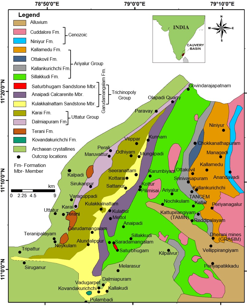
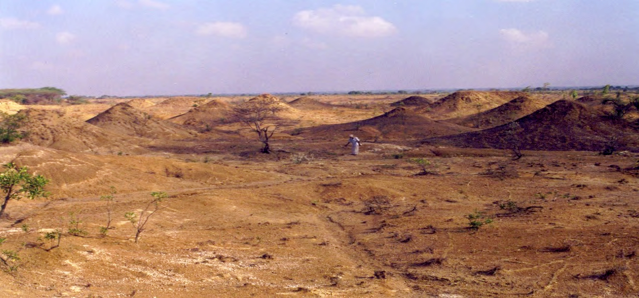
ARIYALUR-TRICHIRAPPALLI OUTCROP: Named after Karai village, Ariyalur district, TamilNadu. Type locality = East of Karai village- the unit popularly known as Bad land topography. Bad land developed in an easterly draining catchment to the east of near Karai village (Sundaram et al., 2001)
[Figure 1: Geologic map of Ariyalur area]
Lithology and Thickness
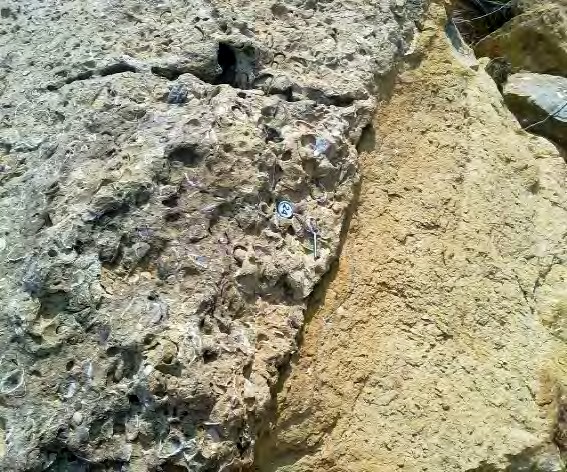
Claystone. Grey-brown, gypsiferous, glauconitic mudstone and marl interbeds with siltstone, calcareous sandstone and coquina in its upper part. The phosphatic concretions and goethite gravels are distributed in the badland. Thickness is computed to 410 m (Sundaram et al., 2001, Nagendra et.al 2018, Banerjee et al., 2016). Part of Uttatur Gr.
The Karai Formation is divided into two members, the Odhiyam and Kunnam, which consist of gypsiferous mudstone, silty sandy clays, and sandstone deposited in a progressively shallowing basin (Sundaram et al. 2001). The contact between the members is conformable, but the upper contact of the Odhiyam member is erosional, which signifies a major regression that terminated the Uttatur Gr. The Karai shale is time equivalent to the Bhuvanagiri Fm in the subsurface of the Cauvery Basin.
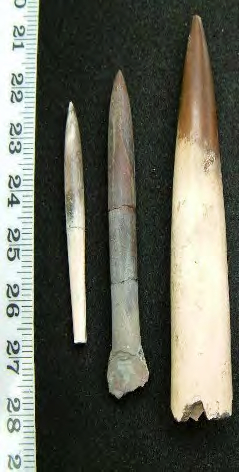
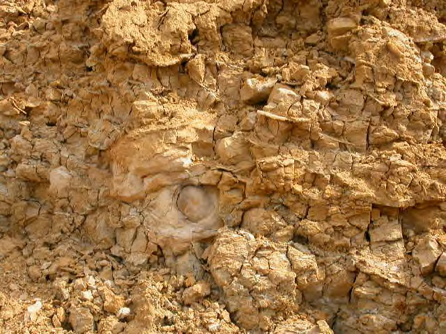
[Figure 2: Field photos of Karai Formation: Karai badland, Belemnites, Coquina contact with Shale, Phosphatic nodules and Gypsum (provided by A. Nallapa Reddy and R. Nagendra)]
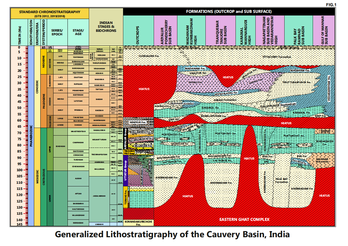
[Figure 3: Generalized Stratigraphy of Cauvery Basin (Provided by A. Nallapa Reddy & R. Nagendra)]
Relationships and Distribution
Lower contact
Para-unconformity with Terani Fm and Karai Shale is a facies equivalent of Dalmiapuram Fm.
Upper contact
Unconformable contact with Kulakkalnattam Sandstone Member of Garudamangalam Fm. This unconformity spans the Late Turonian.
Regional extent
Karai Fm is distributed in NE-SW direction in the vicinity of Ariyalur district. Dalmiapuram Fm and Karai Fm are coeval. Dalmiapuram Fm is present in mine sections at the basin margin and Karai Fm is exposed in a down dip side (east) of the Dalmiapuram. The Karai shale is time equivalent to the Bhuvanagiri Fm in the subsurface of the Cauvery Basin.
GeoJSON
Fossils
Belemnites, Ammonites, juvenile gastropods, lamellibranches, foraminifera, radiolarians, and nannofossils.
Planktonic foraminifera- Narayanan (1972) recorded Planomalina buxtorfi, Rotalipora reicheli, Helvetoglobotruncana helvetica, Marginotruncana sigali, and M. difformis from the “Uttatur beds” (=Karai shale?). Nagendra et al. (2002) reported R. reicheli and Praeglobotruncana stephani from marl beds (=upper Karai shale) in the Kovandakuruchi quarry.
The ranges of these planktonic taxa suggest the age of Cenomanian to middle Turonian for the exposed Karai shale in the bad land area, which has a vertical thickness of 3–4 m. The shortening in thickness of exposed Karai shale may be due to reasons of either differential exposure or/and erosion. This is in good agreement with the shallow cores drilled down to 120 m depth in the Karai outcrops that span the entire shale sequence and recovered well preserved Albian to middle Turonian foraminifer taxa (Govindan et al., 1996; Chidambaram, 2000).
The shallow cores recovered in the Karai outcrop have yielded good assemblage of foraminifera with few useful planktonic index taxa to precisely date the Karai shale.
The depositional environment based on the most common and persistently present calcareous benthic taxa in the Karai shale (e.g., Lenticulina muensteri, L. ovalis, L. taylorensis, L. williamsoni, Gavelinella baltica, G. sandidgei, G. vombensis, Quadrimorphina camerata, Osangularia cardieriana, and Saracenaria triangularis). All other taxa are sporadically present with varying abundances. In these assemblages preponderance of biconvex trochospiral (Lenticulinids) and planoconvex trochospiral (Gavelinellids) morphotypes, followed by infaunal cylindrical forms (Marginulinids, Dentalinids) indicate a low energy, oxygenated environment with a fine- grained substrate. The co-occurrence of arenaceous benthic species such as Ammodiscus cretaceous, Haplophragmoides spp., and Glomospira charoides, although rare and randomly distributed, suggests that outer neritic conditions prevailed during the deposition of the Karai Formation. The benthic foraminifera diversity trend suggests a deepening environment towards the top of the Karai shale. These diversity trends also corroborate deposition in a transgressive phase (Nagendra et al., 2002).
Age
Depositional setting
This formation is considered to represent an SUBSURFACE, highstand depositional environment continuing the transgressive trend apparent for the underlying Dalmiapuram Fm. The belemnites and ammonites are of neritic association and the foraminifera are indications of anoxic intervals (Tiwari et al, 1995). Water depth was within neritic zone. The coarser interbeds and coquina in the upper Kunnam Member and towards the top of the formation indicates shoaling conditions leading to the exposure at the bounding unconformity (Sundaram et al., 2001)
The oxygen isotope data estimated by Zakharov et al. (2006) for belemnite fossils in the Karai shale indicate 16–18°C paleotemperature, which is expected at paleodepths of about 150–200 m.
See Additional Info (below) for details on tectonostratigraphic history.
Additional Information
The early sheared rift extensional faulting initiated during the Late Jurassic/Early Cretaceous (Shyam Chand and Subrahmanyam, 2001; Scotese, 1997), led to the evolution of the Cauvery Basin. This progressive rift seems to have continued until the end of the Turonian (Watkinson et al., 2007), when major phase of Late Cretaceous magmatism synchronous with the India–Seychelles and Madagascar breakup event is believed to be the product of the Marion hot spot that erupted during the Late Turonian (~88 Ma) (Abramovich et al., 2002). The age and compositional similarities between these Upper Cretaceous magmatic rocks from India and Madagascar suggest that this magmatic event reached deep into the Indian Peninsula (Anil Kumar et al., 2001). The rifting possibly resulted in extensive volcanic activity in the vicinity of the Cauvery Basin, contributing a high thermal energy. There is support for this idea from volcanic intrusive encountered in wells KJ–H and UC–C in the Ramnad sub–basin and in Wells Mannar–A, GM–C and GM–G in Gulf of Mannar in Turonian section. The subsurface occurrence of volcanic intrusive in the Ramnad and Gulf of Mannar sub–basins substantiate the magmatic extensions, which perhaps activated the uplift of the Cauvery Basin (Nagendra et al., 2011), resulting in exposure of Karai shale at the western margin.
The abrupt lithological contact between the Karai shale and overlying Kulakkalnattam sandstone further supports rapid uplift resulting in forced regression that produced facies shallowing (missing of intermediate facies) at the Karai/Kulakkalnattam boundary. This forced regression closely correlates with a rapid global sea-level fall during the Late Turonian (Nagendra et al., 2011). The planktonic foraminifera data recorded in exploratory wells revealed that the foraminifer Marginotruncana sigali biozone is absent in the Cauvery Basin. This implies a non-deposition during upper Turonian which can be linked to basin uplift. The upper Turonian thermal uplift of the basin (Courtillot et al., 1988; Raju et al., 1993) resulted in the exposure of Karai sediments in the Cauvery Basin. The uplift also resulted in a hiatus spanning the late Turonian, as Coniacian rocks lie directly over middle Turonian in the outcrops of the Cauvery Basin.
An unconformity straddles the Karai and overlying Kulakkalnattam Fm sandstone in the study area. The Karai shale in the badland area contains ammonites, belemnites, worm tubes and foraminifers. The latter indicates deposition in an outer neritic environment. The Kulakkalnattam sandstone unit of the Garudamangalam Fm (Coniacian–Santonian) consists of abundant burrows represented by Skolithos ichnofacies (Frey, 1973; Pemberton et al., 1992) and characteristic of high-energy near-shore conditions. The juxtaposition of abrupt facies changes may be the result of a basin uplift caused by the rise of Marion plume (Raju et al., 2005) during the late Turonian (Scotese, 1997). The rapid relative sea level fall might have produced the concurrence of these two contrasting lithofacies. The absence of the foraminifer Marginotruncana sigali Biozone both in outcrop and subsurface sections of the Cauvery Basin suggests an unconformity with a hiatus of about 2 Myr during the late Turonian.
A detailed mineral chemical investigation of glauconite within the condensed section deposits of the Upper Cretaceous Karai Formation reflects a wide spectrum in chemical composition related to origin and evolution in different substrates, stratigraphic condensation, and post-depositional alteration. Fe- and Mg- rich glauconite, comprising up to 60% of the sedimentary rocks, occurs as replaced forms of fecal pellets, as infillings within pores and chambers of bioclasts including those of foraminifera, ostracods, bryozoa, and algae, and as altered forms of mica exhibiting vermiforms. Increasing abundance of glauconite pellets from the bottom to the top of the transgressive systems tract, accompanied by a slight increase in K2O within their cores, reflects the effect of stratigraphic condensation on the evolution of glauconite. High Fe2O3 (total) content of glauconite in the Karai Formation may be related to upwelling, although the Fe may be contributed partly by the biotite substrate (Banerjee et al., 2016).
